Posts

Showing posts from May, 2019

You’re Not In Kansas Anymore

Image
Here’s the profile of the ride, 200k’ of climbing. Really not a flat section on the entire ride. It’s either up or down. Elevation gain is equal to climbing Mt. Everest 7 time!  Along with the climbing is spending lots of time at high elevation and the weather. Max elevation is close to 12k where there are wild weather swings.. Along with the extremes come spectacular scenery. Likely to go through several sets of brake pads on the route. 
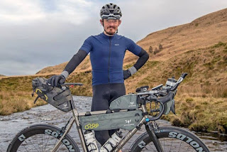
Sure Would Be Nice to Ride The Great Divide With Mike Hall.

Image
In spirt, Mike will ride the Divide with me. I'm a big fan of ultra endurance bicycle racing and Mike continues to be a shining star. Not only was he an unstoppable competitor, he was so well liked by his peers. A tragic loss.  Mike Hall -  https://bikepacking.com/plog/in-memoriam-mike-hall/ Like Mike, I'll begin my ride from Banff, Canada as a touring Great Divide rider and take approximately 50 days to complete. Some how, Mike completed the Tour Divide race in 13 days! 2700 miles, 200K' of elevation.  Mike will be in my thoughts and with me on the ride .... I hope he doesn't mind the pedestrian pace. 

Old School vs. New School

Image
How to navigate the Great Divide Trail? Adventure Cycling Association does a great job producing routing maps for all of their routes. I'm lucky in that they just refreshed the GDMBR  last year so the data is current. There are 6 maps chocked full of info, elevation, distance, where to find water, food, local history, camp sites etc. In addition, I'll be using my Garmin Etrex 20x GPS. All the tracks have been loaded for the route, easy peasy just follow the pink line. While smart phones and car GPS devices are intuitive, the Garmin etrex has a big learning curve. It's like using DOS compared to a modern smart phone. Mona and I have been practicing with the unit on our weekend hikes. Why not just use google maps on your phone? The smart phone is too fragile, the battery life is too short and getting  a satellite signal is not dependable. The phone will be the triple backup! I'll likely pick up state maps as I work my way down.